Now Explore The International Space Station (ISS) With Google Street View By Capturing Images From Outer Space
Since 1998, Google has been growing immensely well in all corners of technology to make people explore the world. It has played a prominent role in this regard. One of its finest features is Google Maps and Google Street View.
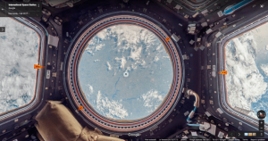
Recently, Google has taken its cameras where few cameras have gone before, capturing images aboard the International Space Station (ISS). It is a first for Street View Imagery. French astronaut and aerospace engineer Thomas Pesquet returned to earth last month after a six-month mission.
With the association of Thomas Pesquet, Google has charted life beyond the blue planet. It has collected images of life aboard the space station. For the last 16 years, the ISS which is the largest man-made body in low orbit has hosted astronauts and scientists 250 miles above the earth, tasked with collecting data on the planet’s oceans, atmosphere, and land surface.
NASA’s Johnson Space Center in Houston and Marshall Space Flight Center in Alabama worked with Google to create a “gravity-free method of collecting the imagery,” Pesquet said. These methods included using DSLR cameras and other equipment already available at the space station. An extended video provides an additional look at how the view came together.
“I collected still photos in space, that were sent down to Earth where they were stitched together to create panoramic 360-degree imagery of the ISS. We did a lot of troubleshooting before collecting the final imagery that you see today in Street View” Pesquet said.
Watch Google Street View Here.
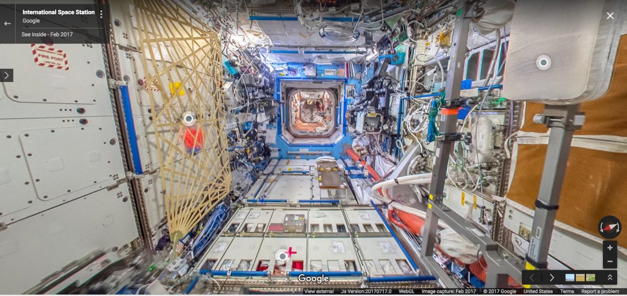
“The ISS has technical equipment on all surfaces, with lots of cables and a complicated layout with modules shooting off in all directions left, right, up, down,” Pesquet wrote. “And it’s a busy place, with six crew members [at the time] carrying out research and maintenance activities 12 hours a day. There are a lot of obstacles up there, and we had limited time to capture the imagery, so we had to be confident that our approach would work.”
Watch The Video Here:
Viewers on terra firma can likewise click on the newly added annotations which will pop up as they explore the space station, revealing fun facts like where the astronauts work out, the kinds of food they eat, and the scientific experiments they carry out. Mapping the ISS could be considered the final frontier for Google Street View: They’ve also taken their cameras underwater, into canyons and over the planet’s highest mountains.
