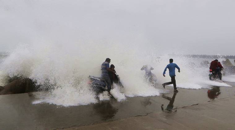
Cyclone Phethai: Storm Characterized by Landfall to Cause Mass Destruction near Kakinada Today

The coastal region of Andhra Pradesh stretching all the way to Tamil are at a risk of getting hit by the cyclonic storm. The storm which develops over the Bay of Bengal is set to hit the region on Monday afternoon. The cyclone named Phethai has shown all the signs of attack and come with a storm and wind speed estimated to be between 70 and 90 km per hour.
With all the anticipation and in readiness to counter the storm when it strikes, the National Disaster Response Force (NDRF) has been put on the alert together with the Coast Guards. Over sixteen teams, both from Fire Services and Andhra Pradesh Disaster Response have exhibited their readiness to encounter the situation. They are already deployed at the Rajamahendravaram region while other teams sent to West Godavari district to keep the road clear. The fishing activities along the Pradesh coast have been stopped by the directives from IMD and no further fishing would take place till the situation turns back to normal. All the fishermen are strongly advised not to go into the deep sea along the Puducherry and Andra north Tamilnadu coast until after 17th when the situation will be under control.
The magnitude of the storm was large until it has been categorized as a cyclone
Cyclone developed into a huge storm and stretches 560 km northeast of Trincomalee and 380 km to the south-southeast of Machilipatnam. The information presented was extracted from the IMD latest report on the matter. It is very possible to traverse from north-northwestward to Andhra Pradesh coast near Kakinada on 17th December afternoon.
The East Godavari district collector Mr Kartikeya Misra made a public announcement that the school within the regions to be affected by the cyclone are to be shut. Specifically, there will be no schooling for two days in the regions of Andhra Pradesh.
Storm to cause heavy downpour in Odisha and its environs
The metrological department has stated that the Phethai cyclone which is just about to hit the Pradesh coastal region by tomorrow is likely to cause heavy rainfall in different parts of Odisha.
The weather condition remained overcast for the better part Sunday but districts such as Kalahandi, Rayagada, Gajapati, and Ganjam are expected to receive heavy rains. The MeT Centre in Bhubaneswar stated in the highlights that those mentioned districts will be influenced by this phenomenal cyclone.
The department also mentioned that regions such as Kalahandi, Kandhamal, Nuapada, Rayagada, Koraput, Malkangiri, Nabarangpur, Balangir, Jharsuguda, Sambalpur, and Baragarh are to receive heavy rains on Monday.
Offer protection to paddy from the unexpected rains: Odisha urged the District collectors
The government of Odisha told the district collectors in the region to deploy precautionary measures in protecting their paddy crop from the storm which is set to strike. Farmers have been urged to get their returns from the field in order not to incur losses. All farmers who still have their paddy stacked in the field should either cover them as appropriate or move them to safety.