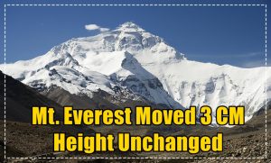
Everest Moved 3 Cm During Nepal Quake But Height Unchanged
One of the highest point on the earth Mount Everest wasn’t any exception to the massive earthquake that took place in Nepal. Official records state that Mt Everest moved three 3cms during the massive earth quaking of Nepal which left the nation devastated killing more than 9000 people. Despite being displaced over 3 cm researchers and the geological experts claim that there is no change in the height of the Mt. Everest.
Mt Everest Moves by 3 cm While Height Remains Unchanged
Chinese official monitoring agency which examined into the issue after the huge record breaking earth quake occurred with Nepal nation aforementioned that the height of world’s tallest mountain has not been affected contrary to earlier reports. Over the past 10 years Mt Qomolangma, another name of Mt Everest, has moved 40 cm to the northeast which also includes the recent displacement due to the Nepal Earthquake occurred during April 25 and May 12. China’s National Administration of Surveying, Mapping and Geoinformation claimed that the previous reports which were unofficial claimed that there has been a change in the Mt. Everest height while it isn’t true.
Observers with the department, which has monitoring equipment on the mountain, found that Mt Everest shifted three cm after the devastating earthquake, while the height of the world’s highest mountain at 8,848 meter was left unaffected, state-run Xinhua news agency reported. This is contrary to reports by Europe’s Sentinel-1A radar satellite that world’s tallest peak may have shrank about 2.5 cm after the quake. China’s National Administration of Surveying, Mapping and Geoinformation which observed and examined during a study carried out after the Nepal’s deadly earthquake disclosed that a broad swath of ground near Kathmandu lifted vertically from the first good view from a satellite which was also reported by the Live Science too.
Satellite study by the Live Science earlier stated that Mt Everest might have, got a bit shorter. On the other hand the China’s National Administration of Surveying, Mapping and Geoinformation data contradicts this one. The devastating 7.9-magnitude earthquake that struck Nepal on April 25 and hit by another earthquake measuring 7.3 on Richter scale on May 12 killed over 9,000 people and left injured around 21,000 people.
China’s National Administration of Surveying, Mapping and Geoinformation data during the research observation period from 2005 to 2015 indicates that Mt. Everest has been moving at a speed of four cms per year and has been growing by 0.3 cms annually. Mt. Everest is located geographically on the collision belt for the boundary between the Indian and the Eurasian Plates, where the crustal movements are active. Chinese experts further added that the Geographical changes in and around the area of Mt. Everest have a great influence on the climate, environment and ecology of East and South Asia. China’s administration has set a satellite to carry on its observation on Mt. Everest in the year 2005 and has been continuing it since then.